


Mappa Monday
 Dear Reader, give yourself a treat and check out this map. It is jam-packed with facts and fun.
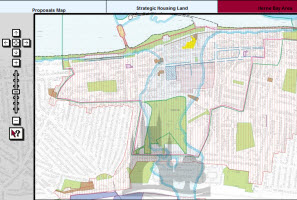
Just the other day, I quizzed CCC about the Herne Bay Conservation Area. I had heard people (well, estate agents) talking about it, but had no clear idea of where exactly it was. Quick as a flash One-Of-Those-Planning-People came back with a couple of great links. One of them links to this excellent map of the Canterbury District Local Plan. The left hand side of the screen explains how it all works.
This is a detailed, zoomable map of the whole CCC fiefdom, showing conservation areas, cycle routes, flood zones, offices nodes (huh?), ancient monuments, open spaces, regeneration zones, etc, etc. There's an associated Local Plan document that spells it all out in words of English. Words, pictures - whatever works for you.
I don't know if every District Council has one of these maps, or if CCC are blazing a trail. If it's the latter, congratulations, people: a great piece of mapping.
 CCC | Keywords:
Reader Comments (1)
Dear hernebaymatters.com
We are the company who made this interactive map and we love your positive comments.
Can you e-mail and let me know what you did with the website? peter.hall@chk.co.uk